Google is reimagining what’s possible with Maps by releasing a suite of AI-powered tools that help developers create dynamic, interactive projects using real-world data. The company announced a new builder agent, a Model Context Protocol (MCP) server, and an integration powered by its Gemini models, all designed to make coding on top of Maps faster, easier, and more creative.
According to Google’s developer blog, these updates mark the next step in blending artificial intelligence with geographic data, helping users and developers go from idea to prototype in minutes.
From Text Prompts to Working Prototypes
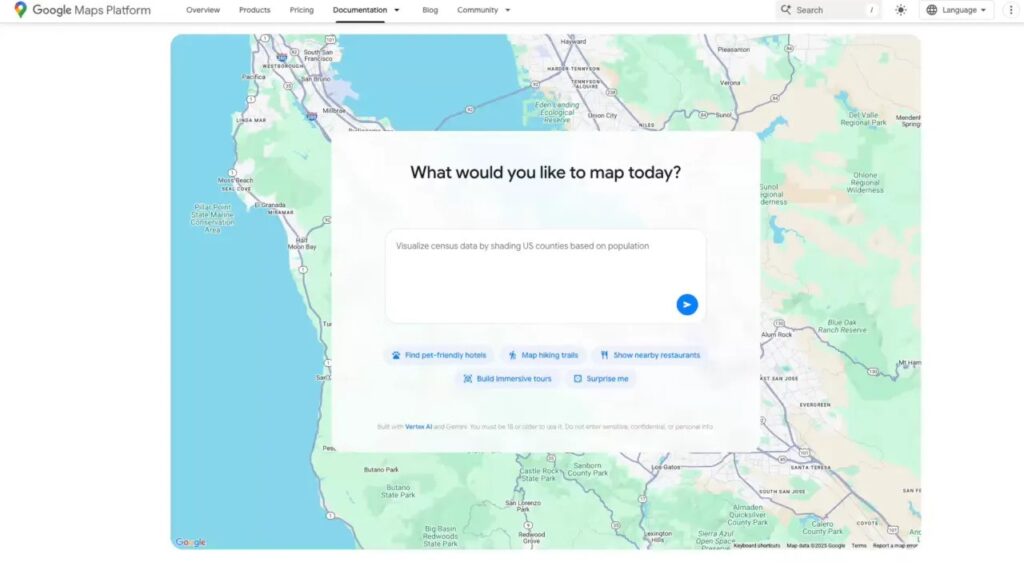
The new builder agent acts like a co-developer. Instead of manually writing lines of code, you can simply describe your idea in plain language, such as “create a street view tour of San Francisco” or “visualize real-time weather across Texas”, and the agent automatically generates the project code.
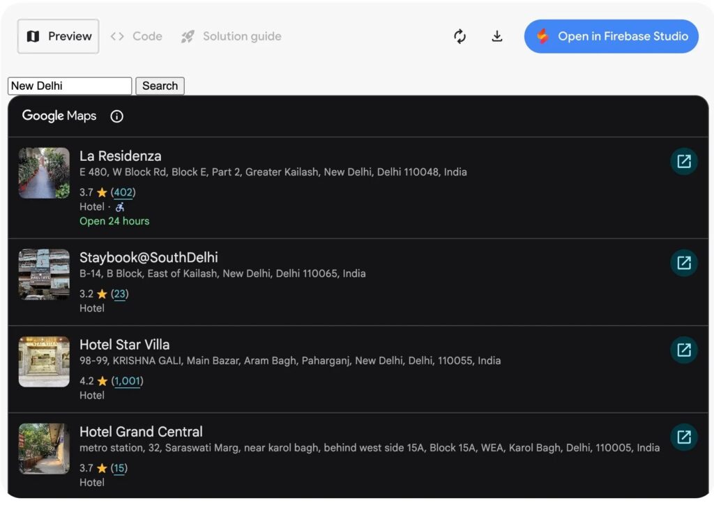
Once the system builds your prototype, you can preview it, test it with your own API keys, or edit it through Firebase Studio. This functionality opens the door for small businesses, educators, and developers to design interactive maps without needing deep technical expertise.
The tool also includes a styling agent that helps users personalize map visuals to fit their brand or theme, from subtle grayscale styles for real estate projects to colorful, branded layouts for travel apps.
Grounding AI Models in Real Data
Google is expanding how developers can anchor AI models in live location data through its Gemini API. Alongside existing map grounding features, the company introduced Grounding Lite, a lightweight version that connects an AI model directly to real-world information using the MCP standard.
With this approach, AI assistants can provide context-aware answers such as “How far is the nearest pharmacy?” or “Show me EV charging stations near my office.” The addition of Contextual View, a low-code Maps component, enhances these interactions with dynamic visual displays, offering 2D or 3D map views, lists, or custom layouts that bring spatial data to life.
For developers, these capabilities streamline the process of embedding AI-enhanced maps into products without requiring manual integration of datasets.

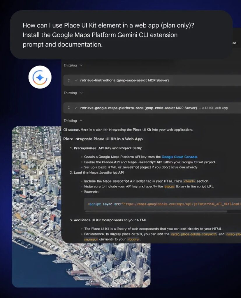
The MCP Server and Developer Toolkit
The new MCP server connects directly to Google Maps’ technical documentation. This means developers can ask practical questions like “How do I pull live traffic data?” or “What’s the API call for map styling?” and receive direct, actionable answers.
This feature aligns with Google’s recent push to make Gemini more accessible across development environments. Just last month, the company launched Gemini CLI extensions that give command-line users direct access to Maps data. Now, with the MCP server, those same capabilities extend to web-based projects and collaborative workflows.
AI-Powered Maps for Everyday Users
The AI rollout isn’t just for developers. Google continues to expand Gemini integration within Maps for everyday users as well. In early November, the company added hands-free Gemini navigation and, in India, introduced new incident alerts and speed limit data.
These features hint at Google’s broader ambition, to turn Maps from a navigation app into an intelligent spatial platform that responds to context, intent, and creativity.